
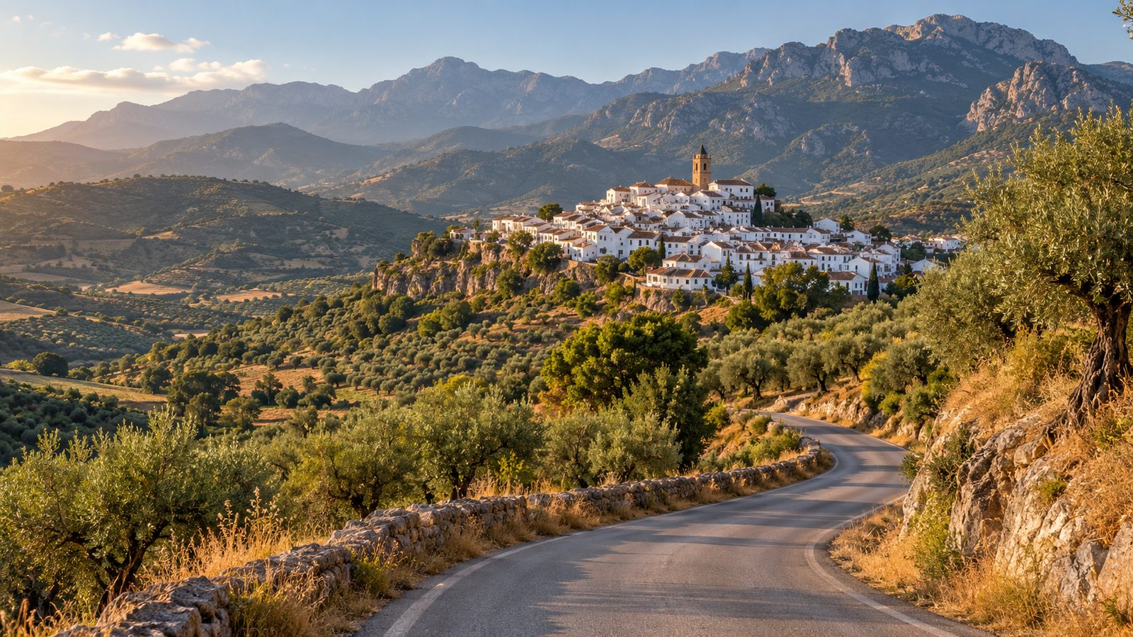
White walls, terracotta roofs, pots of geraniums on every windowsill. The white villages of Andalusia, “pueblos blancos” in Spanish, stay in your head far longer than a beach in Torremolinos. They sit in the mountains between Malaga and Cadiz, one after another, linked by roads you will not find on any bus timetable.
And that is the point. Some of them have no bus at all, the rest get one or two a day. Without a car this route simply does not exist. Below you have two ready-made versions: a one-day loop with three villages and a two-day trip with all seven. With distances, driving times and parking in every village.
In this article:
It is not just a village painted white. The pueblos blancos grew up in Moorish times as defensive settlements, wedged into slopes and ridges, often around a castle or a watchtower. The limewashed walls bounced the sun back and kept the houses cool inside. As a bonus, they kept insects away.
The layout is always similar. Narrow lanes climbing uphill, a church on the square, a castle or its ruins at the top. And a viewpoint from which you can see the next village on the neighbouring hill. Most of them ban traffic from the historic core, so you leave the car at the entrance and walk from there. That is actually good news, because these lanes really were not made for cars.
The best-known trail, the “Ruta de los Pueblos Blancos” (Route of the White Villages), runs through the provinces of Cadiz and Malaga. On paper it takes in a dozen or more places. In practice, the seven below are the pick of them.

This one is for anyone with a single free day and a base on the Costa del Sol. About 260 km in a loop, realistically 9 to 10 hours with stops.
Malaga > Mijas Pueblo (32 km, about 35 min). You leave on the A-7 along the coast, then climb on the A-368. Mijas sits about 430 metres above sea level, with a view over the whole bay. It is the most touristy of the three, but also the easiest to reach. See the oval Plaza de Toros bullring and the Muralla gardens.
Mijas > Ronda (85 km, about 1 h 20 min). You drop back down to Marbella and head into the mountains on the A-397. It is one of the best-looking stretches in Andalusia: hairpins through the Sierra de las Nieves, with the sea in your mirrors. Ronda is the star of the route. The El Tajo gorge cuts the town in two, and the Puente Nuevo bridge ties it together, 98 metres above the bottom.
Ronda > Setenil de las Bodegas (20 km, about 25 min). A short hop on the A-374, then a local road. Setenil is unlike all the others: the houses do not stand beneath the rock, they are built into it. A rock overhang forms the roof of Calle Cuevas del Sol, with bars and shops trading underneath.
Setenil > Malaga (about 125 km, about 1 h 45 min). Back via Ronda and the A-357, or on the longer but faster road through Campillos.

Here you add four villages in Cadiz province and a night in Ronda. About 430 km in total.
The same run as the one-day option, minus the drive back. You stay the night in Ronda, so you get the town in the evening, once the coaches have gone. The Puente Nuevo lit up after dark looks nothing like it does at midday.
Setenil or Ronda > Zahara de la Sierra (about 35 km, about 45 min). A village on a steep hill, with a ruined Moorish tower on top and a turquoise reservoir at its feet. The view from the car park at the entrance is postcard enough.
Zahara > Grazalema (17 km, about 30 min). A short distance, but the most spectacular stretch of the whole route. The CA-9104 climbs to the Puerto de las Palomas pass, more than a thousand metres above sea level. The hairpins are narrow, and in a few places there is no crash barrier. Grazalema lies inside a natural park and is the rainiest place in the whole of Spain. In Andalusia that sounds absurd. It is a fact.
Grazalema > Ubrique (30 km, about 40 min). Ubrique has lived off leatherwork for generations and makes handbags for European fashion houses. It is the only village on the route where shopping makes sense.
Ubrique > Arcos de la Frontera (about 55 km, about 50 min). The finale. Arcos sits on a rocky ridge above a bend in the Guadalete river, and its old town is the largest of the seven. Plaza del Cabildo gives you a view over the valley from a hundred metres up.
Arcos > Malaga (about 180 km, about 2 h). Back on the A-382 dual carriageway, then the A-384 and the A-357.

The rule is the same everywhere: park at the entrance, walk in. Here are the details.
| Village | Where to leave the car | Notes |
|---|---|---|
| Mijas Pueblo | covered car parks on Avenida de Méjico and by Plaza Virgen de la Peña | paid, about €1.20 to €1.80 per hour, full before 11:00 in summer |
| Ronda | Martínez Astein and El Castillo (paid), or San Cristóbal and Plaza Pruna (free) | paid ones €1.80 to €2.40 per hour, free ones a 10 to 15 min walk from the bridge |
| Setenil de las Bodegas | car park at the entrance, on the Ronda road side | small, full before noon at weekends, nowhere to stop in the centre |
| Zahara de la Sierra | car park below the village, by the access road | usually has spaces, then a 5 to 10 min walk uphill |
| Grazalema | the square at the entrance and spaces along the main road | free out of season, tight in summer |
| Ubrique | car parks on Avenida Doctor Solís Pascual | the widest choice of the seven, as this is the least touristy village |
| Arcos de la Frontera | car park at the foot of the old town, not at the top | lanes at the top are 2 m wide in places, do not drive up |
Mountain cooking is not coastal cooking. Less fish, more meat, cheese and soup.
Kitchen hours can catch you out. In the villages they usually serve from 13:30 to 16:00, then close and reopen only after 20:00. Turn up at 17:00 hoping for lunch and you end up with a petrol station sandwich.
The Jerez wines are for the passenger. The driver has a legal limit of 0.5 g/l, and in a Car4Rent car the rule is zero alcohol. Limits, fines and how a roadside check works are covered in our guide to drink driving in Spain 2026.
Spring, March to May. The best time. The slopes are green, wild flowers are in bloom, and daytime temperatures run between 18 and 26 degrees. Grazalema can be wet at the end of winter, but that water is what makes all those green hillsides.
Autumn, October and November. The second-best choice. Fewer tourists than in spring, still warm, and the olive harvest in full swing.
Summer, July and August. Doable, but Ronda and Setenil can hit 38 degrees, and the white walls throw the heat straight back at you. Set off at 7:00, do two villages before noon and sit out the afternoon in the shade. And keep water in the car, because there is nowhere to buy any between villages.
Winter. Chilly, with the occasional snow in Grazalema, but the villages are empty and that has a charm of its own. Check the forecast before you go, because the passes can be closed.
| 1-day option | 2-day option | |
|---|---|---|
| Villages | 3 (Mijas, Ronda, Setenil) | 7 (plus Zahara, Grazalema, Ubrique, Arcos) |
| Distance | about 260 km | about 430 km |
| Time at the wheel | about 4 h | about 7 h |
| Fuel (6 l/100 km, €1.77 per litre) | about €28 | about €46 |
| Overnight stay | none | 1 night, ideally in Ronda |
| Tolls | none | none |
The whole route runs on toll-free roads. No toll booths, no passes to buy, just petrol and parking.
Yes. The one-day loop takes in Mijas, Ronda and Setenil and covers about 260 km. All seven villages need two days and about 430 km, and every section is toll-free.
Setenil de las Bodegas is the most distinctive, with houses built under a rock overhang. Ronda, with its bridge over the gorge, makes the biggest impression. Zahara de la Sierra has the best view from a distance.
Only some of them. Ronda and Arcos de la Frontera have buses, though not many. Setenil, Zahara and Grazalema get the odd connection or none at all. A car is the only way to do the route in a sensible time.
Spring, from March to May, or autumn, in October and November. In summer, temperatures in Ronda and Setenil reach 38 degrees.
No, not technically, but they need your full attention. The stretch from Zahara to Grazalema over the Puerto de las Palomas pass has narrow hairpins high in the mountains. Drive in daylight and take your time.
Always in the car park at the entrance to the village. The historic cores have lanes two metres wide and traffic restrictions. In Setenil and Arcos, getting an ordinary car in can be physically impossible.
1.5 to 2 hours for an unhurried walk, the viewpoint and a coffee. Ronda needs more, at least 3 hours.
The route is ready, the car parks are listed, the kilometres are counted. All that is missing is the car. At Car4Rent Malaga you rent with no deposit and no credit card, with service in English or Polish around the clock. We bring the car to the airport terminal, or to your hotel as a paid extra, and the paperwork takes 15 to 20 minutes. Mileage within Andalusia is unlimited, so 430 km of mountain roads changes nothing on the bill.
➤ Check availability and prices
See also:
 Contact phone number/Whatsapp:
 E-mail:
 Opening hours:


